Hyperion Coast Redwood
World's tallest discovery, 2006, Redwood National Park, 379.65 ft.
Plus info about closure and fines

Mario D. Vaden, Certified Arborist / PN-5584A
Hyperion was discovered 2006, published as the tallest known redwood for about 7 years. Prior to 2014 Hyperion was published as 379.65 feet tall and 15.2 feet diameter. In 2017 there was a updated measurement of 380.08 feet and diameter of 15.87 feet. In May of 2025, Chris Atkins, Michael Taylor and John Harvey remeasured the Hyperion redwood at 381.01 feet tall.
At any recent moment maybe 12 people (scientists & redwood gurus) know which redwood is actually the tallest tree. Hyperion is the tallest on record at the moment. Around 2008 more redwoods were measured, some found by LiDAR. Those and other known tallest redwoods grew - some had tops snapped-off. The tallest redwoods continually surpass each other due to growth, breakage or collapse. For now, I have a reliable report that Hyperion's top is still intact and growing. Also, the 2nd tallest has surpassed 378 feet.
Hyperion was found August 25, 2006 by Chris Atkins & Michael Taylor, in Redwood National Park. They found 3 world records that year, giving Redwood National Park claim to three tallest in the same park.
Between 2013 - 2016 heights shuffled and by 2014 Redwood National Park lost claim to 3 tallest in one park as one redwood in Humboldt Redwoods State Park added more height. My Redwood Discovery page adds a little more extra about ongoing redwood discovery and exploring.
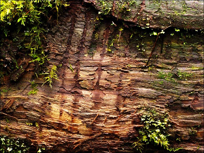
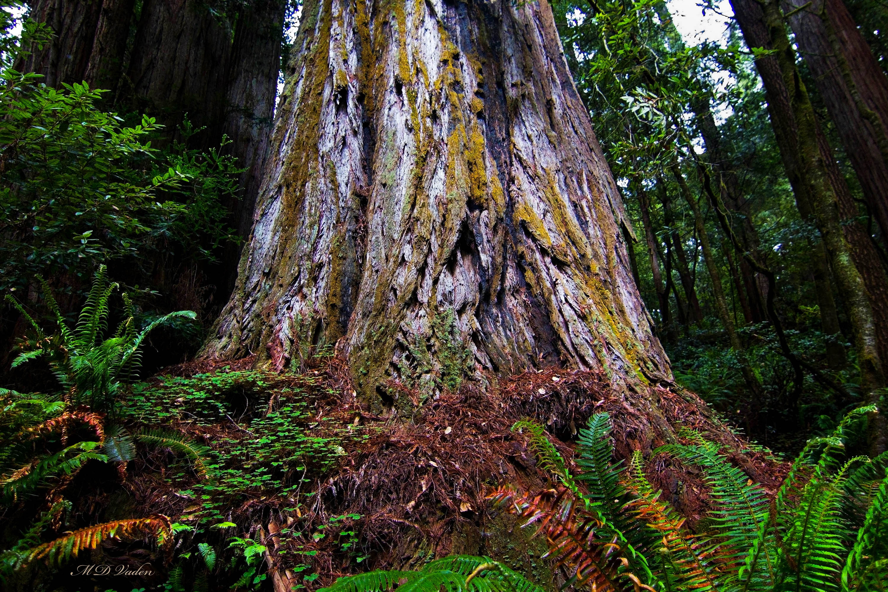
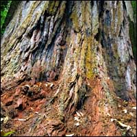
From 2006 to 2013, near Hyperion, there were no traces of wear or human activity. In 2015, one of the original group who found Hyperion in 2006, noted some obvious changes denoting that an unknown number of people were traipsing through. From my own photos I picked a large image showing the base of Hyperion early 2014. Everything was pristine.
Tap and enlarge the photo to the right >>
That 2014 image is a perfect benchmark for future comparison. I skipped returning to Hyperion 2015 to 2020 (+) to avoid partaking in permanent wear. Chris Atkins shares similar thoughts.
A friend's image is farther down this page in updates showing beginning stages of human impact.
NOTICE OF CLOSURE
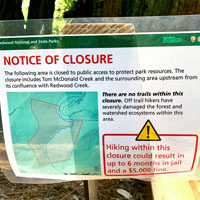
Image: here's a 2022 photo from Mark Graham updating status of the area around this redwood.
Redwood National Park closed an area across Redwood Creek river from Tall Trees Grove where people are spreading out and crossing the river to wander and look for this tree. So it's not just the tributary leading to Hyperion, but a swath of forest across the river.
The sign warning is up to 6 months in jail and $5000 fine. Much of this park and other redwood parks don't have this restriction but the wear is becoming obvious. As often in the past, the park's statement tends to sound like lying or hyperbole instead of just stating the facts. The sign says off-trail hikers caused severe damage to the forest and ecosytem. The truth is that various spots shows some wear to vegetation along with a small social path - a path comparable to what the parks allowed Fish & Wildlife workers (alone) to form in Jedediah Smith park near Mill Creek in the Grove of Titans. But the restriction was logical since the small amount of wear would have increased and not decreased.
Staying out of some groves was our own personal practice at the Grove of Titans. We used to visit for photos prior up to 2014. As soon as permanent wear began due to careless people, we abandoned going to areas for several years. The parks built boardwalks already at that grove. But that would be impractical and destructive between Tall Trees Grove and the world's tallest tree, especially if another redwood becomes the tallest.
Regarding the closure around Hyperion, Redwood National Parks may have lied to news outlets and the public. One or more news stories stated that the top can't be seen from the ground, but that's false. If you find the old National Geographic video on Youtube about the first climb to confirm the height in 2006, watch the end where the scientist is shown waving at the top. That was filmed from the creek at ground level.

I photographed the top from ground at the same angle in 2009. The reason I'm interjecting this is because if the parks isn't telling the truth about one aspect, it leaves people wondering what other aspects are true or not.
RNP / rangers were factual when they told news or the public that there is danger or hazard to bushwhacking up to Hyperion. The danger varies from very dangerous during some winter weeks to moderately hazardous in summer. There are some slippery rocks or logs 365 days of the year.
Image: the image to the right (used with permission) shows the partially broken arm of a man about 30 years of age.
That is not the only injury from that area. It's just one of several that someone shared a few years ago to let people know that the trek does involve some risk. There have been more injuries and falls. This is true of bushwhacking in other parks and groves too.
It's worth adding that I also injured an arm in similar fashion while measuring for the LiDAR project and exploring with Chris Atkins. A Salal plant wrapped my angle resulting in a fall 8 feet down off a log which broke a small piece of bone. I was still able to work. But I realize the potential hazard in the parks apart from the fact that hikers can also get injuries on regular open trails.
This potential for injury is one of several reasons why ranger-led or guided tours by permit won't happen. It would be foolish for rangers to try that.
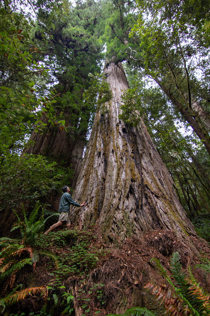
Some of my photos below show people standing near the trunk. It's worth interjecting that they approached and walked behind to avoid standing on plants. Their footing is on thick needle mulch so compaction was impossible.
The image below is the oldest top-to-bottom view of Hyperion. This is the complete photo farthest-removed from human influence, taken one cold rainy January 23rd back in 2009. This photo is available for purchase and several others have purchase it on 16 x 32 print canvas
I will spare directions. Years ago, some folks liked figuring it out themselves. But nowadays the area is offlimits and various people know it's a wade and bushwhack up Tom McDonald Creek. But it's risky going there. The fine is high and it's a known fact that cameras have been placed in places.
Even years ago I rarely trekked to this redwood because it takes plenty of time. There's driving, hiking, and about 1/2 mile of bushwhacking up a creek. Just going to Tall Trees Grove takes more time than other redwood trails due to the permit, gate access and drive to park.

advertisement
My first encounter with Hyperion in 2009
My first time to Hyperion was January 22, 2009 when the trek was a real adventure. Clues were very scarce, hence the "good old days". I approached the valley and reached Hyperion around 11:45 am. It was overcast, cold and rainy. My clothes were saturated almost chest high from wading water to 4 feet deep. Weather records state 43 degrees F. barely 10 degrees above freezing.
Michael Taylor never shared the location but encourage me to proceed and keep trying. Apparently I was the first "outsider" to locate Hyperion. I used scraps from Richard Preston's redwood book and the rest was based on arborist intuition of what seemed like a good place for a tallest redwood.
Redwood Creek was full that day and so were the tributaries. Some spots were deep enough to raise the back pack overhead. Unlike lookers these days (2018), I identified Hyperion by the apex, not the base. In winter the area feels like a wilderness. I recall being apprehensive because I went solo. When I spotted claw marks on logs it made me nervous. But afterward, I focused on redwoods and photos. By afternoon I was comfortable and the day became one of my most memorable redwood adventures.
Hyperion
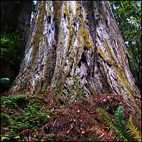
Is mostly a single stem redwood with some fire charring on the trunk, and looks like a stereotypical Sequoia sempervirens. The stem length is greater on the low side of a hill. If Hyperion was removed from the Earth and hung from a crane, the trunk would stand at least 386 feet tall.
Around August 26, 2006, Dr. Robert VanPelt referred to the redwood as "unnamed" adding "The most significant year in tree height measuring just joined the ranks of years like 1066, 1492, etc."
During the first climb shown by National Geographic, researcher Steve Sillett said foliage near the top was not as reduced in size as expected. The needles still had some "expansion" indicating potential for extra height. He was correct because Hyperion has grown more.
The first climb involved Dr. Steve Sillett, his wife Marie Antoinne, Jim Spickler and author Richard Preston. National Geographic's film crew tagged along plus three officials from Save the Redwoods League, including Ruskin Hartley who carried the crossbow for Sillett. It was September 16, 2006. Michael Taylor and Chris Atkins who discovered were also present that day. If you search around Youtube, a repost of that show can be found. The video quality isn't stellar but it's interesting.
Image: a friend Richard Stenger looking skyward to one of the "hook-arm" trunk reiterations.
My Favorite Hyperion Story
My favorite story by others is the 2007 Above and Beyond by Clynes. Even though I have been to Hyperion several times, I still enjoy reading this fun article.
If you can find it online, read: Above and Beyond Article
The narrative unfolds where it has me guessing they picked Redwood Creek trailhead close to Orick. That article opens weighing options in hours and pints of blood. Their first search party had a 75% casualty rate for injuries the first day.
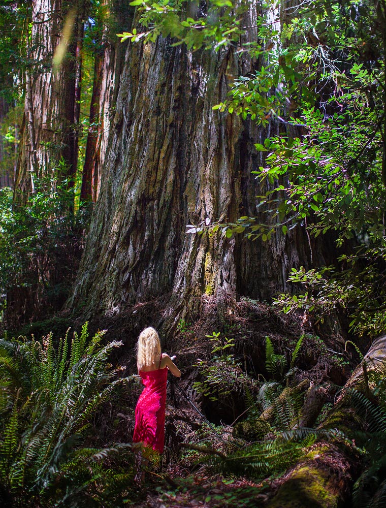
Image: Another photographer at the base of tall Hyperion redwood. May 1, 2014. It was over 80 degrees that day.
Clynes never found Hyperion but closed his story with a great appreciation for the forest. Clynes contacted co-discoverer Chris Atkins afterward. April, 2015, Chris and I stopped for supper and I asked him about his conversation with Clynes. Atkins confirmed the authenticity of the phone conversation.
Clynes went up several creeks and "trimmed fat" off the narrative to conceal the exact details where the "right place" was. Here's an excerpt:
"Wow," he (Atkins) said. "You managed to find your way into one of the most spectacular groves on earth." He asked a few more questions, regarding how far up the creek we went, which side we climbed, how high we went. After I described the location, Atkins was silent for what seemed like a long time. "You were in the right place," he said finally. "You probably walked right past it"
Clynes and his team never found Hyperion but he sure provided a great narrative of their quest.
Keyhole in the Landscape
Richard Preston wrote of a keyhole in the landscape, leading to Hyperion Valley. For a while, it made no sense. Eventually, I realized what spot in the park can be described as a keyhole. Since the location is obscure, I revealed a "keyhole" farther down down this page
December 2016 Update
Hyperion may not see the same traffic as the Grove of Titans. But it's fair to document any activity and change for the record.
A reader here, saw the image I added at the top of the page showing Hyperion's base in pristine condition during early 2014. The reader submitted a photo taken near Hyperion from the end of summer 2015, a year and few months afterward. It confirms what I was told by a researcher that the area was starting to get "thrashed"
Select the image to the right for a larger view. The more orange areas are where boots grind-down bark surface. The small vegetation has been reduced evident by comparison to my 2014 image shown earlier.
If you enlarge the photo there is no way to miss the wear. This is exactly what the first phase of wear looked like around the base of Screaming Titans in Jedediah Smith park before spreading to hundreds of square feet.
Although wear will continue, it will be at a slower pace than Grove of Titans because testimonials have been found and read about wear in the GOT, and this creek drainage is more remote. and by now (2025) the threat of fine greatly diminished people even looking for Hyperion.
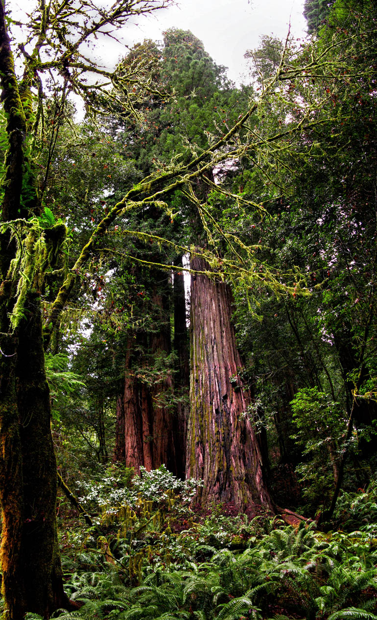
Image: Hyperion redwood from another angle, showing more forest density.
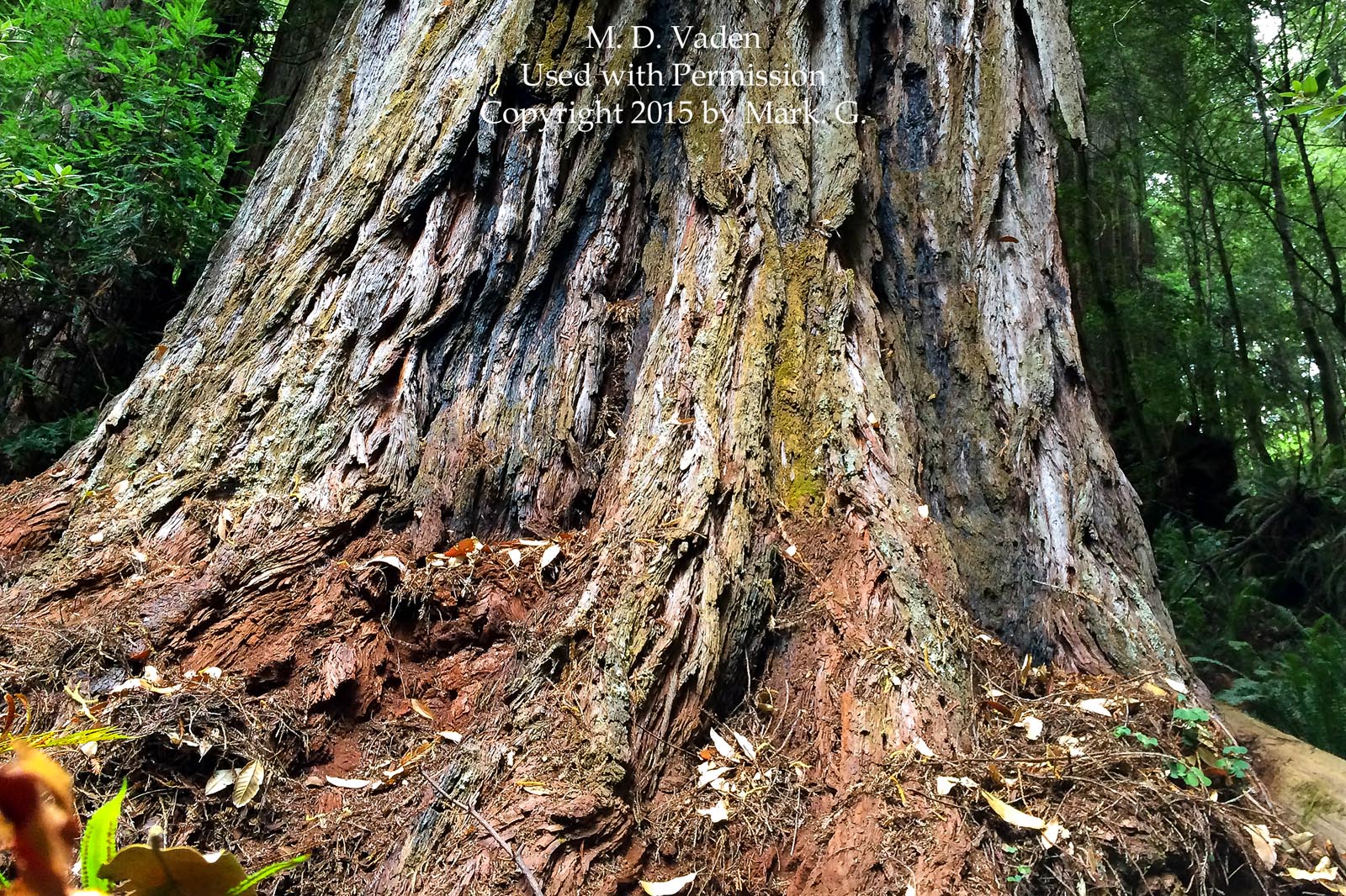
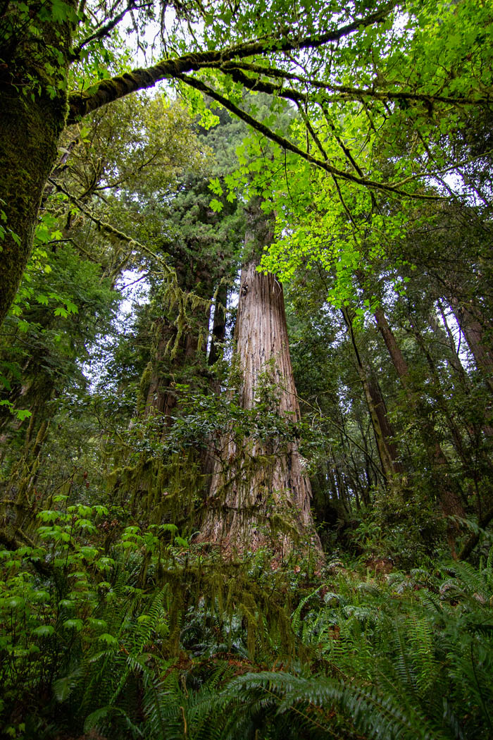
Image: Chris Atkins, co-discoverer of Hyperion, swimming in Redwood National Park in the area described by author Clynes in the Backpacker Magazine article Above and Beyond.
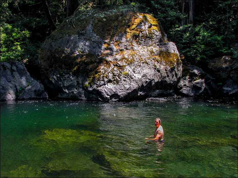
Image: the "keyhole in the landscape" described by author Richard Preston. It becomes more distinct during overcast weather and looking from this direction.
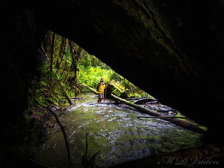
Image: Hyperion Valley in Redwood National Park, winter time, January 23, 2009.
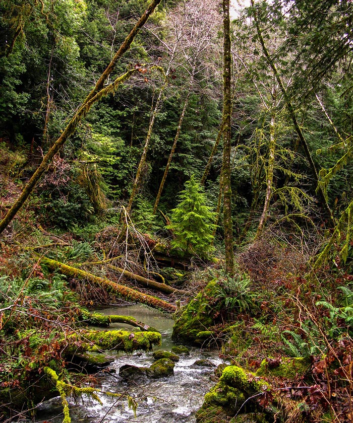
Image: Hyperion Valley, January 23, 2009. Cold, saturated and swollen with rainwater.
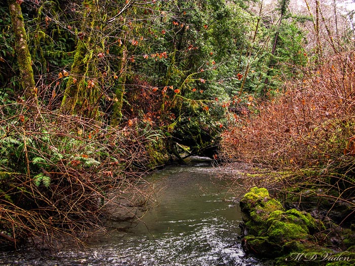
Image: scores of fallen logs packed like sardines from the power of raging floodwaters. January 23, 2009. Hyperion Valley in Redwood National Park.
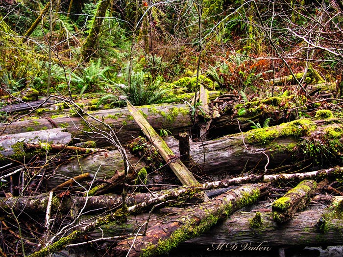
Image: Claw marks in close proximity to Hyperion redwood. The claw marks were wide, implying the bears are large. But the length of the claw marks proved that getting a foothold is just as slippery for bears as it may be for humans.