Doerner Fir .. Brummit fir
Tallest Douglas fir .. directions .. photos .. Orphic Rock falls
Copyright 2011 by Mario Vaden
The Doerner Fir is the tallest Douglas Fir in the world, and the largest in Oregon. It is located in the Oregon Coast mountains west of Roseburg, near the Burnt Mountain Recreation area in BLM forest. The Doerner Fir was measured at 327.3 feet in 2011. The trunk 11.5 feet diameter. It was discovered in 1989 by a man named Hank Williams. Two years later it was measured, at 329 feet. Previously called the Brummit Fir after the drainage, it was renamed after a Douglas Co. commissioner.

advertisement
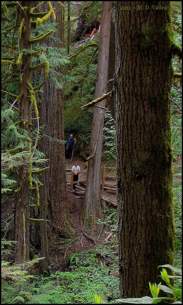
The photos show the Doerner Fir from the trail in front, plus looking down from higher up the same trail. This is just under a 2 hour drive from Oregon Coast destinations like Bandon, or Coos Bay. A 90 minute drive from Roseburg. GPS provided was: 43.179909,-123.810904
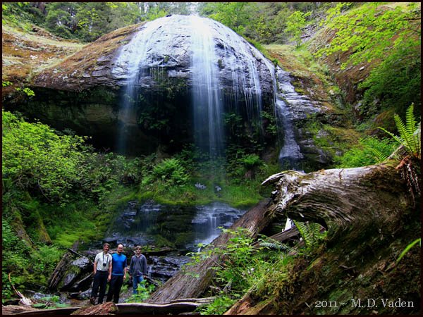
Orphic Rock Falls: The waterall is near the East Fork Bennett Creek Road on the way down to the trailhead. It can be seen behind branches as you drive down. The waterfall photo below was taken June 2011, with Chris Atkins, Mike Hunuschik and Michael Taylor.
Directions from Coos Bay: go south on Highway 101 and Highway 42 to Coquille. Turn left onto Fairview - Coquille Rd., then to Four Corners in Fairview. Turn right on Coos Bay Wagon Road and go 3.9 miles to Middle Creek Access Road. Turn left and continue 13.6 miles to a four-way intersection. Turn right onto Burnt Mountain Middle Creek Tie Road and go 4.8 miles to Burnt Mountain Access Road. When you come to a T intersection, turn left for another 4.9 miles to East Fork Brummitt Creek Road. Drive about 4.5 miles to the marked trailhead.
Directions from Interstate 5: You can go to the BLM office in Roseburg to see a map. Our route: Interstate 5. A few miles south of Roseburg, take the Coos Bay & Winston Exit 119. Go west about 3 miles into Winston and make a right turn on OR-42 (Douglas Blvd. / Coos Bay - Roseburg Hy.). Continue 8.8 miles to Tenmile. Go another 2000 feet on Hy. 42 then make a right turn and head north on Reston Road. After 4,5 miles take a left onto Coos Bay Wagon Road. Head west for about 12 miles then go right onto BLM Road 28-8-16 (toward Burnt Mountain Access Road). After about 4.6 miles veer or turn left toward Burnt Mountain Access Road. Go 2 more miles and turn left toward Burnt Mountain Access Road. Go another 0.2 mile and turn left toward Burnt Mountain Access Road. After 1.1 miles go left onto East Fork Bennett Creek Road. You may see a sign at this point for the Doerner Fir. Proceed 4.4 more miles to the Doerner Fir trail parking. All that remains is a 1/2 mile hike. You could also go through Roseburg west and connect using Harvard Avenue and Lookinglass Road.
The top 40 feet is declining, and the upper 10 feet is dead top, slowly crumbling away. When another 5 feet disintegrates, the 322 foot live-top Doug Fir we found in 2011 will replace the Doerner Fir as tallest Doug fir.

It is a bit of a drive to come and view the Brummit Fir. But even though there was logging in this forest over the years and decades, I found the drive through these mountains to be quite panoramic and scenic.
There are a few spots where camping would work, but it would not be my choice. With the Oregon Coast, Grants Pass and Roseburg not far away, I'd go to one of them for motel lodging or a campsite. Surprisingly, this is only about 2.5 hours from the Oregon State Park Humbug Mountain and town of Port Orford, also at the Oregon Coast.